Road closures and restricted areas in the Southeast Fire Centre

By Nelson Daily Staff
The Duncan-Glacier Creek Forest Service Road located north of Lardeau is part of a number of road closures and area restrictions that are in effect throughout the Southeast Fire Centre.
The road, as well as others in the Rocky Mountain Natural Resource District and the Selkirk Natural Resource District, have been closed for fire suppression activities further to the current backcountry closure.
The roads in the Selkirk Natural Resource District include:
- The Harrop Mainline Forest Service Road and the East Harrop Mainline Forest Service Road. A map of the affected area can be viewed at: http://ow.ly/do6Z30eUmWQ
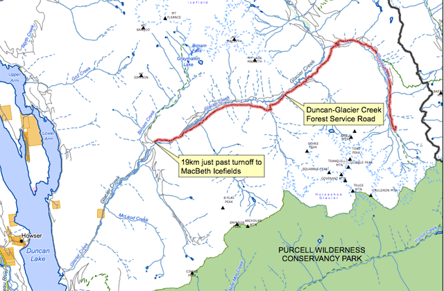
- Duncan-Glacier Creek Forest Service Road, 19 kilometres past the MacBeth Icefields turn off. A map of the affected area can be viewed at: http://ow.ly/eHqc30eUimY
Roads in the Rocky Mountain Natural Resource District include:
- The White Rock Forest Service Road from the 34-kilometer mark, extending to the 73.3-kilometer mark, and the White Swan Forest Service Road from the 10-kilometer mark to the 32-kilometer mark. A map of the affected area can be viewed at: http://ow.ly/ZiCx30eUifi
- Lamb Creek Forest Service Road starting at the 1.5-kilometre mark, at the Mineral and Lamb Creek Forest Service Road junction, up to the Whitney and Irishman Creek Forest Service Road Junction. A map of the affected area can be viewed at: http://ow.ly/SnGm30eNyMn.
- Also, there is an area restriction in effect for Moyie Lake. This restriction means no watercraft are permitted on Moyie Lake at any time. A map of the affected area can be viewed at: http://ow.ly/WSCP30eUizs
- The Palliser Forest Service Road starting at the 54.25-kilometre mark. A map of the affected area can be viewed at: http://ow.ly/IhAY30eUhHh
- The Quinn Creek Forest Service Road starting at the 60-kilometre mark at the Bull River Junction Forest Service Road. A map of the affected area can be viewed at: http://ow.ly/2Qp430eN86M
- White-Schoefield Forest Service Road starting at the 78-kilometre mark, the White River Forest Service Road starting at the 32-kilometre mark and the White-East Fork Forest Service Road starting at the 60-kilometre mark. A map of the affected area can be viewed at: http://ow.ly/xX2j30eUirt
- Lodgepole Forest Service Road from the 35-kilometre mark to the 42-kilometre mark. A map of the affected area can be viewed at: http://ow.ly/d67k30eUkrG
These are full road closures, meaning that no person, at any time, or for any reason, can use these roadways. These closures take precedence over any other previously released restrictions.
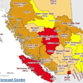
The Southeast Fire Centre extends from the U.S. border in the south to the Mica Dam in the north and from the Okanagan Highlands and Monashee Mountains in the west to the B.C.-Alberta border in the east. It includes the Selkirk Natural Resource District and the Rocky Mountain Natural Resource District.
To report a wildfire or open burning violation, call *5555 on a cellphone or 1 800 663-5555 toll-free.
For the latest information on current wildfire activity, burning restrictions, road closures and air quality advisories, visit: www.bcwildfire.ca
You can also follow the latest wildfire news:
* On Twitter: http://twitter.com/BCGovFireInfo
* On Facebook: http://facebook.com/BCForestFireInfo