Cottonwood Creek Overpass slated for rehabilitation; farmland use in region to be studied

By Timothy Schafer
One of the city’s major bridges will be getting a facelift, courtesy of the province.
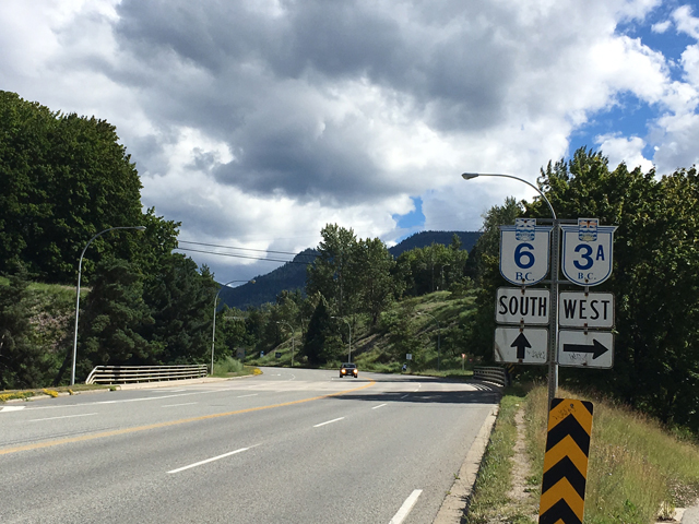
Cottonwood Creek Overpass — located in the city’s west end north of Rosemont — at the interchange of Highway 3A and Highway 6 will be rehabilitated this summer.
The work on the 42-year-old bridge will entail resurfacing the bridge deck, replacing bearings and deck joints, repairing the contract pier caps, pier columns and strengthening the girders.
Work is scheduled to begin toward the end of July, with a scheduled completion in October.
The city’s five-lane bridge was originally built in 1974 and has seen a considerable amount of traffic over the years, said Minister of Transportation and Infrastructure Todd Stone in a statement.
“This rehabilitation project will resurface the bridge deck, extending the service life of the structure and increasing safety for motorists and pedestrians,” he said.
Keeping bridges in good condition was “critical” to highway safety and a key component of B.C. on the Move, the province’s 10-year transportation plan (no major projects were planned for the West Kootenay region).
“Staying on top of bridge repairs means less costly problems down the road,” Stone added.
One lane of traffic will be remain open in each direction at all times, except for up to five night time overpass closures that will be required between 10 p.m. and 5 a.m. and will be advertised in advance.
A contract for the work was awarded to Kingston Construction Ltd. from Surrey to rehabilitate the overpass at the interchange.
Work on Highway 3A between the Taghum Bridge and the junction with Highway 6 is also underway, resulting in single-lane alternating traffic. Motorists should check DriveBC.ca for updates on both projects.
The province is resurfacing around 25 kilometres of Highway 3A — between the Taghum Bridge and Playmor junction. That project began last week and is expected to last until August 15.
Other projects have been announced for the area, including Highway 31 from Balfour to Ainsworth and local side roads — a total of 116 lane kilometres.
The work on that stretch will consist of asphalt removal and replacement, and drainage and shoulder improvement.
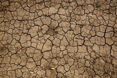
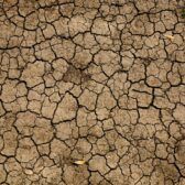
Field of dreams
There will be something new afield in the regional district’s rural areas this summer.
The pastoral and agrarian features of the Regional District of Central Kootenay’s rural areas will be under the microscope and information will be collected over the next few months on the land-use status of farming areas in the region.
The RDCK announced that agrologists would be touring the rural areas in the next two months on the fact-finding mission, but will also develop a water demand model.
“Agriculture is an important sector in the RDCK and for it to succeed, water must be available,” read an RDCK staff release.
In what is viewed as the long term viability of both the natural resource and the industry, the Ministry of Agriculture, the Regional District of Central Kootenay, and the Partnership for Water Sustainability in BC are working together to gather data that will be used by the RDCK for planning purposes, and by the Ministry of Agriculture to develop an Agriculture Water Demand Model.
There are several aspects to an agricultural land use inventory. Conducted in the summer months, the inventories can identify land use, irrigation methodology, crop type, and livestock use for parcels in the agricultural land reserve.
In addition, the potential to grow specific crops in the region is assessed for specific parcels with agricultural capability (soils and climate).
It is expected that the agricultural land use inventory (ALUI) will bring together the many disparate threads of the region’s agricultural industry.
Once complete, the inventory is predicted to deliver a consistent inventory of rural agricultural land across the region.
The inventory will also define the amount of actively farmed land in the region as of 2016; act as a benchmark for monitoring land use change; and will assist land use decision-making including official community plans and bylaw updates.
As well, the inventory will help identify how various proposed policies and regulations would impact farmland use, while informing the RDCK’s understanding what the challenges are that face farmed land use, and identify any opportunities to enhance agriculture.
The inventory will potentially identify opportunities to improve land use and resource “compatibility.”
At the same time, the Agricultural Water Demand Model (AWDM) will be built with data pulled directly from the inventory findings, and will allow for a scientific estimate of the amount of water needed to supply the agricultural water demand for current and future scenarios — including climate change.
The demand model could also improve understanding of farmland water demand patterns specific to the central Kootenay region, and allow an examination of any management alternatives that consider future land use changes.
Although the water demand model will be designed as a similar model that was developed for the Okanagan basin in 2006, the Kootenay model will define the potential impacts of climate change in the area and identify any relevant and possible adaptation strategies.