Ministry said access to Idaho Peak closed for indefinite period of time
The Ministry of Forests, Mines Natural Resources Operations and Rural Development said access to Idaho Peak will remain closed for an indefinite period of time after a part of the forest service road to the popular tourist hiking destination was washed away in May.
In an emailed statement, a ministry spokesperson said staff have been busy assessing the damage and continue to evaluate the next steps to take to remediate the access to the forestry lookout above New Denver.
“A geotechnical field review was conducted on Thursday June 18/2020 to assess the site at 1.5 km and an aerial survey was performed via helicopter the same day,” the spokesperson for the Ministry of Forests, Mines Natural Resources Operations and Rural Development said Monday.
“A prescription for road repair/remediation and the subsequent costing is being evaluated.”
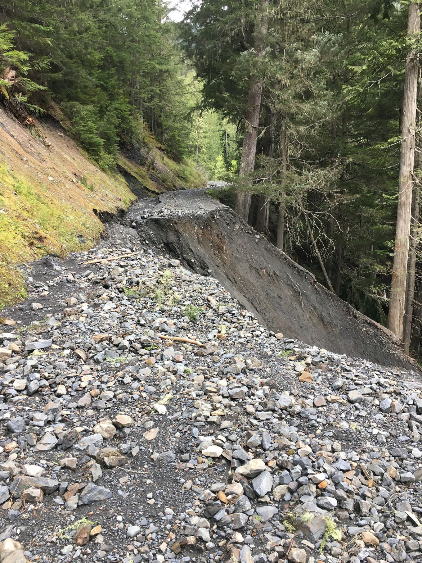
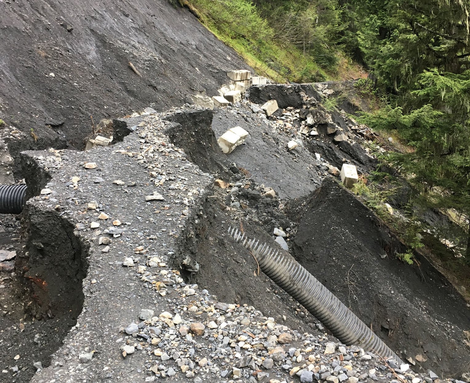
The ministry said at approximately 1.5 kilometer on the road a stream culvert was overwhelmed by the storm freshet on May 31, 2020.
“The culvert inlet was plugged with woody debris and a debris torrent,” the Ministry of Forests, Mines Natural Resources Operations and Rural Development said.
“The plugged culvert inlet forced the stream flow onto the road surface, scouring the road for approximately 375 meters.
“The running surface is badly scoured to a depth of 1.5 m and there are two large fill-slope failures resulting in the complete loss of the road prism.”
Damage this part of the forestry road is considerable and is expected to close the road to vehicle access to the local hiking attraction for months.
Idaho Peak trailhead is located 12 kilometers from Sandon, which is 14 kilometers east of New Denver on Highway 31A, up a windy forestry road.
The two-kilometer hike from the parking lot to the old fire lookout station at the peak provides tourists some spectacular panoramic views of New Denver and Slocan Lake below and mountain peaks above, including the New Denver Glacier to the west, Kokanee Glacier to the southeast and Mount Cooper to the Northeast.
“There were no other notable failures observed upgrade of the site at 1.5 km,” the Ministry of Forests, Mines Natural Resources Operations and Rural Development said.
“(However) considerable snow still persists above 1600 meter in elevation.”

A stream culvert was overwhelmed by the storm freshet on May 31, 2020, taking big chunks of the forest service road away. — Facebook photo John Matthews


