Avalanche danger in backcountry flirts with 'high' risk
By Timothy Schafer, The Nelson Daily
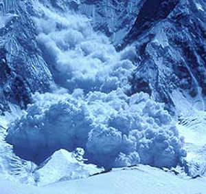
Avalanche danger at and above the tree line in the West Kootenay backcountry remains considerable heading into Friday, according to the Canadian Avalanche Centre.
High winds and new snow over the next three days will set up touchy wind slabs on mainly north to south east areas of the backcountry, said CAC’s James Floyer.
Due to the strength of the winds, cross loading — wind blowing across a slope, depositing drifts on the sides of gullies or other terrain features — is also a concern.
If new snow amounts today and tomorrow are greater than 15 centimetres, warned Floyer, then the avalanche risk in the alpine will be elevated to high.
“The timing and amounts of snowfall are uncertain,” he said.
There have been reports of small, relatively harmless natural and skier-triggered avalanches on northerly slopes in the alpine and at the tree line.
Very strong winds have created variable wind slab deposits on lee slopes and features at all elevations, said Floyer in his CAC report for Tuesday, with windward slopes heavily eroded.
Below the tree line the snow pack is generally well settled.
Weather forecast
Tuesday: Moderate snowfall with 10-15 cm. likely. Freezing levels around 1,100 metres. Strong (extreme in the alpine) southerly winds in the morning becoming light to moderate southeasterly in the afternoon.
Wednesday and Thursday: Continued moderate snowfall with freezing levels dropping to valley bottom. Winds light to moderate southwesterly.
Considerable risk means …
Dangerous avalanche conditions. People venturing above the tree line should exhibit careful snow pack evaluation, use cautious route-finding and conservative decision-making is essential.
Natural avalanches are possible in these conditions, with human-triggered avalanches likely. Small avalanches will occur in many areas, or large avalanches in specific areas, with very large avalanches in isolated areas.


