Province issues emergency alert after water begins spilling over slide blocking Chilcotin River

By Contributor
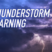
The province issued a BC EMERGENCY ALERT due to flooding after water began flowing through the landslide on the Chilcotin River Monday.
Evacuate immediately if you are in the following area: anywhere on the rivers or along the banks of the Chilcotin River from Hanceville to the Fraser River, and the Fraser River from the Chilcotin River to the Gang Ranch Rd Bridge.
Flooding and debris flow in and around the Chilcotin and Fraser Rivers poses a threat to human life.
Evacuate immediately if you are in the evacuation area
If you are unable to evacuate call 9-1-1.
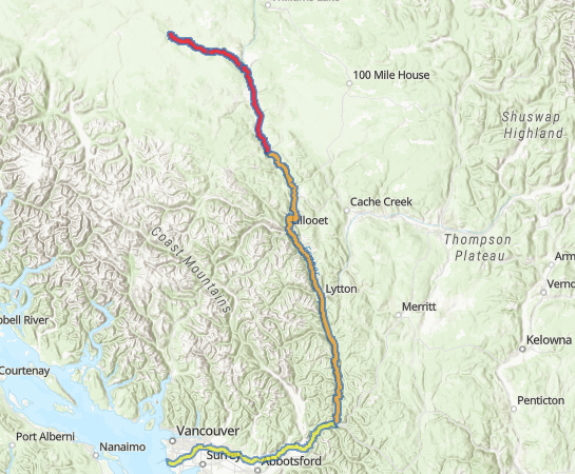
There had been minimal seepage of water through the natural dam created by the landside on Tuesday, July 30, 2024, so the water level behind the dam has continued to increase steadily in recent days. It is rising at a rate of about 18 centimetres per hour.
People are urged to keep out of the Chilcotin River valley between Hanceville and the confluence of Fraser River. An evacuation order issued by the Cariboo Regional District remains in place. People are also advised to stay away from the banks of the Fraser River. Planning continues to address potential impacts of debris as it relates to public safety.
Risks to public safety include the potential for further landslides upstream of the natural dam and downstream of the dam once water begins to flow past it.
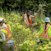
The landslide incident poses potential impacts to spawning salmon and other fish species. The Province is working with First Nations and Fisheries and Oceans Canada to establish an incident command structure, mobilize resources and plan mitigation efforts.
The Province is preparing for all possible outcomes since modelling does not provide guarantees. Provincial personnel and partnering agencies continue to work day and night to gather real-time information from the site, to prepare for any mitigation that may be necessary, and to keep people in British Columbia informed and safe. The Province will continue to share the latest information with the public as it becomes available.
As water makes its way down the Chilcotin River and Fraser River, the Province will monitor water levels and will continue to provide updates. Real-time water-level monitoring information is publicly available through the Water Survey of Canada: https://wateroffice.ec.gc.ca/
New web portal for Chilcotin River landslide information:
The B.C. government has created a new web portal to share information about the Chilcotin River landslide with the public and members of the media.
This site includes photos and video of the landslide site and nearby areas; information bulletins issued to date by the Ministry of Emergency Management and Climate Readiness and the Ministry of Water, Land and Resource Stewardship; a link to updates issued by the River Forecast Centre; mapping information and additional resources.