Against the clock: Time to share thoughts and help plan the future of parks, trails and water access

By Timothy Schafer Local Journalism Initiative Reporter
People still have time to fill out a survey on the region’s parks, trails and water access in the regional district.
Late last month the Regional District of Central Kootenay (RDCK) embarked on a month-long engagement process to support the development of a regional parks, trails, and water access strategy, engaging people through an online survey (filling out a survey link) that closes June 19.
The strategy is expected to help inform the planning, decision-making, and management of the Regional Parks and Trails Services over the next 10 years in the RDCK.
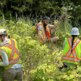
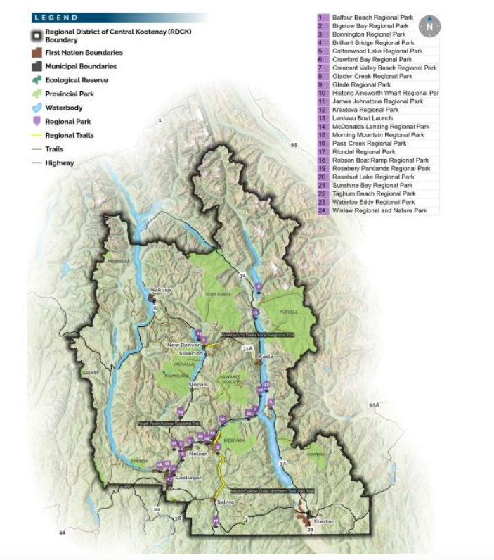
Towards that end, the RDCK is seeking residents input to hear their thoughts on the current state and future of regional parks, trails, and water access points in the RDCK.
“Our goal at the RDCK is to provide top-notch nature-based recreation opportunities while supporting the economic, social, and environmental objectives of the region,” said Trisha Davison, RDCK regional manager of Recreation and Client Services. “To achieve this, we’re crafting a Regional Parks, Trails, and Water Access Strategy to guide our efforts for the next 10 years.”
Through the information gathered in the engagement period a clearer understanding of the existing parks, trails, and water access areas will be developed, as well as well of how the needs of residents are being met, what opportunities can be pursued in the future, and the RDCK can make it happen.
“We value input from all residents, whether you are a regular user of parks, trails or water access points or not,” said Davison. “Resident feedback will help guide our efforts to enhance these vital resources and ensure we are moving in the direction RDCK residents want.”
Residents can share their thoughts placing points and adding comments onto an interactive map.
- People can learn more about how to participate in the Regional Parks, Trails and Water Access Strategy engagement process at engage.rdck.ca.
What are water access areas?
Public access to the waterfront is provided along road rights-of-way that end at the foreshore.
In regional districts the rights-of-ways are owned by the Province and are under the jurisdiction of the Ministry of Transportation and Infrastructure (MOTI).
To make use of water accesses for park or trail purposes, the RDCK must seek a permit from MoTI.
Source: RDCK
How long will the survey take to complete?
Approximately 20-30 minutes depending how detailed responses are.
Do I have to answer all of the questions?
You are encouraged to answer each question. For data analysis purposes, only some of the questions are mandatory.
When does the survey close?
June 19 at 4:30 p.m.
Who do I contact if I have further questions about the strategy or planning process?
For further information please contact: Mark Crowe, Parks Planner: [email protected], Phone: 250.352.8172
Source: Regional District of Central Kootenay