Downsized: snowpack shrinks well below normal, creating concern for drought

By Timothy Schafer Local Journalism Initiative Reporter

The West Kootenay regional snowpack remains extremely low in May.
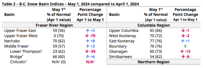
According to the Snow Survey and Water Supply Bulletin — produced by the B.C. Rivers Forecast Centre — increases in the West Kootenay snow basin indice since April 1 is largely due to a delay in snowmelt rather than a significant increase in snow water equivalent.
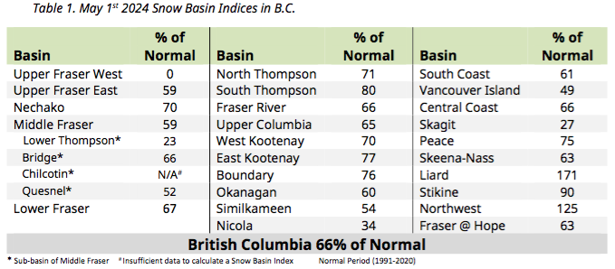
In the West Kootenay, the snowpack has dropped to 70 per cent of normal — down from 72 per cent last month. As of May 1, the provincial snowpack is extremely low, averaging 66 per cent of normal across B.C. Last year, the provincial average was 91 per cent.
“The May 1 survey provides insight into possible late season snow accumulation, the timing of snowmelt onset, and whether melt is early, late, or following seasonal patterns,” noted the report.
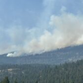
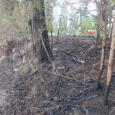
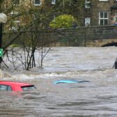
A below normal spring freshet flood hazard is expected this season for most of the West Kootenay and Boundary region due to low snowpack, but local flooding from extreme rainfall is still a possibility.
“Low snowpack and seasonal runoff forecasts combined with warm seasonal weather forecasts and lingering impacts from on-going drought are creating significantly elevated drought hazards for this upcoming spring and summer,” the report explained.
Rain and snow
In general, precipitation was below normal in April for the Kootenay region as well as most of the province.
Overall, temperatures throughout British Columbia were near normal in April ranging between a -0.5°C to +0.5°C average anomaly.
The onset of the snowmelt season has been mixed across the province.
In low-to-mid elevations, particularly in plateau terrain in the B.C. Interior, early melt of a shallow snowpack has occurred and many of these areas are now snow-free.
“Higher elevation mountain snowpack has experienced a delay in melt due to cooler temperatures in late April, and some areas experienced additional late-season snow accumulation during recent unsettled weather periods,” the report explained.
The regional snowpack decreased by two percentage points since April 1 to 70 per cent of normal for May 1.
Chance of weather
An El Niño advisory is still in effect, according to the Climate Prediction Center at the U.S. National Weather Service.
El Niño is the warm phase of the El Niño-Southern Oscillation (ENSO), meaning conditions trend toward warmer winters across B.C., with below normal snowpacks and earlier snowmelt.
The CPC forecasts a likely transition to ENSO-neutral conditions over the April to June 2024 period (85 per cent chance).
“A La Niña Watch remains in effect from the CPC, with increasing odds of La Niña conditions developing in June-August (60 per cent chance) and likely continuing and impacting B.C. into fall-winter 2024-25 (next year),” noted the report. “La Niña winters are often relatively cool and wet, potentially causing delayed snowmelt if cooler temperatures persist.”
Seasonal weather forecasts from Environment and Climate Change Canada (ECCC) continue to indicate a moderate likelihood (40-95 per cent chance) of above normal temperatures across all of B.C. over the May to July period.
Current projections for May to July suggest above normal precipitation in portions of the southern Interior and Kootenays.