UPDATED: BC prepared for winter driving at higher levels
Environment Canada said a low-pressure system moving southeast across Vancouver Island will continue to give snow at times heavy Friday, with snowfall total amounts of 10 to 15 cm is expected.
“Totals accumulations of 10 to 20 cm can be expected over most areas,” Environment Canada said.
“However, lower elevations of the south Okanagan are receiving mixed rain and snow. The snow will ease to a few flurries or showers this evening as the low moves to the south.”
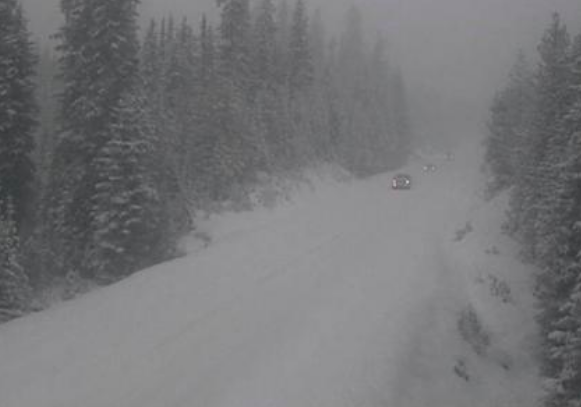
Environment Canada issued said drivers should be aware of changing driving conditions at the higher elevations of Highway 3, Paulson Summit to Kootenay Pass.
Visibility may be suddenly reduced at times in heavy snow with surfaces such as highways, roads, walkways and parking lots may become difficult to navigate due to accumulating snow.
Environment Canada issues Special Weather Statement for Boundary, West Kootenay
Environment Canada issued a Special Weather Statement Thursday for the southern interior of BC, including the Boundary, West Kootenay regions.
Environment Canada said an early season snowfall is expected on Friday as Arctic air arrives which will bring below seasonal temperatures continuing through the weekend.
“A low pressure system will pass just off Vancouver Island Friday morning and move onto the Washington coast Friday evening,” Environment Canada said.
“Meanwhile, modified Arctic air will advance southward through the B.C. interior. By Friday afternoon, the Arctic front is expected to reach Kamloops and pile up against the east side of the Rockies.”
Environment Canada said With a somewhat cool airmass already in place, widespread snow is expected from Bella Coola and Whistler eastward to 100 Mile and the southwest interior, and further to the Kootenays and parts of the Columbia regions.
“Snow may become mixed with rain over southern and eastern portions of this area. Currently, forecast snowfall amounts range from 5 to 15 cm,” Environment Canada said.
Environment Canada said in the wake of the low, a drying trend begins on Saturday as the Arctic air spreads through the rest of the southern interior with temperatures of 10 degrees below seasonal normal is expected through the weekend.
Anyone travelling Highway 3 Paulson Summit to Kootenay Pass should be prepared to adjust their driving with changing road conditions.
Go to the ShiftintoWinter website for information regarding winter driving.


