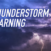
Long weekend watch brings warnings of water, not fire

By Timothy Schafer
Water, not fire, may be biggest bane of long weekend leisure
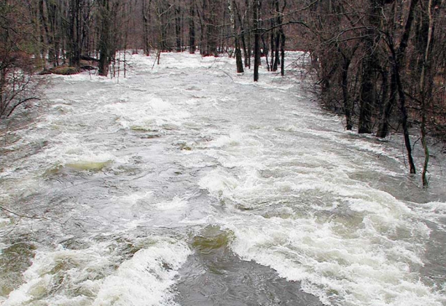
People seeking the outdoors this May long weekend should be more wary of waterways than of lighting a fire as meltwater in the region’s creeks and rivers continue to increase.
As a result of higher than usual snowpacks and heavy rains, many regions are experiencing high river flows and flooding, with rivers and creeks overflowing their banks and carrying increased amounts of heavy debris.
Even though the high stream flow advisory for the Granby River (Grand Forks), Salmo River (Salmo) and the Moyie River (Yahk) has ended, there is still some cause for concern in every area where water is moving right now, the BC Rivers Forecast Centre advises.
As the long weekend approaches, people in the West Kootenay are urged to be careful while enjoying outdoor activities, due to the elevated risk of flooding in many areas.
River levels in most areas, including the Kootenay and Columbia rivers, peaked on Tuesday and have been receding since. The Granby, Salmo and Moyie rivers all peaked below their two-year flow levels earlier this week.
River levels are now below levels of concern, the Centre stated in their daily report. But a high pressure ridge is moving into the area of the West Kootenay for the next two weeks, meaning warmer temperature throughout the region and an increase in snow melt rates.
For those looking to light one up this weekend (meaning a fire), open fires, campfires and forest use are all permitted, according to the Southeast Fire Centre.
There has been sufficient moisture in the area from the snowmelt to allow people to enjoy a good burn — and from the major amount of sun expected this weekend — for the next three days.
As of Thursday there are no road closures or commencements of road construction according to the DriveBC website.
If you go
- If you are planning to spend time outdoors – especially in low-lying areas or near bodies of water – check with your local regional district about areas of concern, or review the Province’s current flood information at www.newsroom.gov.bc.ca/emergencyinfobc.
- You can also find up to date information on the flooding situation via Emergency Management BC’s Twitter feed. Just follow @EmergencyInfoBC.
- To report severe flooding in your area, contact your local municipal government or the Provincial Emergency Coordination Centre at 1 800 663-3456.
Quick facts
Residents should consider the following preparedness actions:
- To report severe flooding in your area, contact your local municipal government or the Provincial Emergency Coordination Centre at 1 800 663-3456.
- Be aware of streams, drainage channels and areas known to flood suddenly.
- Avoid small creeks and rivers, as their channels tend to be narrow and can fill up quickly.
- Keep children and pets away from stream banks. The banks can erode quickly.
- Do not walk or drive through floodwaters.
- Pay attention to weather conditions when you are out camping or enjoying outdoor recreational activities. If it starts to rain heavily, leave the area. Roads can get washed out quickly, and could leave you stranded without a way out.
- Boil water taken from all outdoor sources like rivers or creeks before drinking.
- Open water can become contaminated from beaver dams, overflowed septic tanks or other sources.
- Organize your individual and family emergency kit. It should contain important documents, prescription medication, a flashlight and first aid kit.
- Secure your home. If instructed, turn off utilities at the main switches or valves.
- Listen to radio or television stations for local information and weather reports.
Learn more
- Flooding information from the Province of BC: www.newsroom.gov.bc.ca/emergencyinfobc/
- Emergency planning information from the Provincial Emergency Program: www.pep.bc.ca
- Current driving conditions and road closures: www.DriveBC.ca