April showers bring May flooding as conditions could worsen

By Timothy Schafer
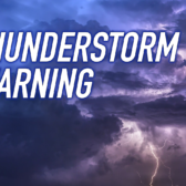
Brace yourself, the danger of flooding is expected to worsen as the month of May wears on, according to snow pack reports and the weather predicted in the next few weeks for the West Kootenay.
With a snow pack in the Kootenay River region sitting at 142 per cent of normal, and the Lower Columbia at 111 per cent, there is plenty of white stuff still up on top of the neighbouring mountains right now.
According to the May 1 snow survey by the Ministry of Forests, Lands and Natural Resource Operations, the danger of flooding this month will likely depend on the weather coming down the pike for the West Kootenay.
A cool and rainy spell will last for three days in the region, predicted the Weather Network, before giving way to nearly two weeks of dry and above average daytime highs.
“The greatest risk for flooding occurs when there is still significant snow available for melt and weather brings well above normal temperatures or heavy rainfall,” the report warned.
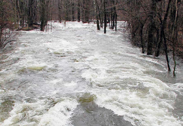
Which is what Mother Nature has in store for the West Kootenay region. Based on the elevated snow pack level, the report is predicting well above normal spring runoff in the Kootenay and Lower Columbia, with increased flood risk expected in both areas.
“Whether or not significant flooding occurs in these systems will depend primarily on the weather during the snowmelt season in May and June,” said the report.
The transition from snow to snow melt occurs typically near the middle of April. However, this year a cool April has led to an increasing snow pack in the West Kootenay, and a delayed snowmelt. As of May 1 the delay in the onset of melt is about two weeks later than normal.
Even still, there are no flood warnings issued for the West Kootenay region.
The provincial river forecasting centre has issued flood warnings for several areas of B.C.’s Interior including Nicola River near Merritt, Bonaparte River at Cache Creek and the West Kettle River, near Westbridge, and further north in the Quesnel area, along the Willow and Cottonwood rivers.
Stretches along the Salmon River in the Falkland-Westwold area northwest of Vernon are also on flood watch.
La Niña
The La Niña cycle that has been present in the equatorial Pacific Ocean throughout the 2010-2011 winter is continuing to weaken, and the National Oceanic and Atmospheric Administration (NOAA) is commenting that La Niña will approach neutral conditions by June 2011.
La Niña conditions typically bring cooler than normal and wetter than normal weather to British Columbia. The persistence of La Niña conditions into the spring period may affect the melt of the snow pack through the freshet period.
Environment Canada is forecasting warmer than normal temperatures for the summer period (July-August). Weather during the May to June period will affect the specific flood risk in snowmelt driven rivers of the province.
The River Forecast Centre will continue to monitor the snow pack, weather, and stream flow conditions throughout the snow melt period.
- Source: BC River Forecast Centre
twitter.com/#!/TheNelsonDaily