Sunny days mean danger stays in West Kootenay backcountry

By Nelson Daily Editor
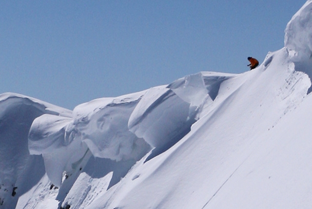
Direct sun hitting new snow is likely to trigger loose snow avalanches, driving the danger in the West Kootenay backcountry to considerable for the next two days, according to a Canadian Avalanche Centre report.
Slab avalanches are also more likely as temperatures rise, said the report prepared by CAC’s Penny Goddard.
Cornices in most areas of the backcountry are large and could trigger an avalanche on the slope below, she said.
“Avalanche conditions will change rapidly with the influence of warming or sun and could rise to considerable or high at any elevation through the day,” she said.
Goddard advised people heading into the backcountry to limit exposure to avalanche terrain during any periods of rapid warming.
“Try starting your day early and plan to be far from any large, sun-baked slopes in the afternoon,” she said.
The timing and intensity of the next snowstorm is uncertain. Friday will be sunny and clear, Saturday will be dry and warm and Sunday will be light to locally moderate snowfall.
Numerous loose snow and soft slab avalanches in the size one to two range were triggered naturally, by skiers and by explosives, over the last few days, mostly on wind-loaded slopes.
Up to 80 centimetres of new snow overlies previous storm snow above 1,900 metres and a crust below about 1,900 m. Southwest winds have formed touchy wind slabs on lee aspects.
Several buried sun crusts exist in the upper snow pack, particularly on solar aspects. The mid- and lower-snowpack layers are well consolidated.