Storm snow complicates backcountry — at least for one day

By Nelson Daily Editor
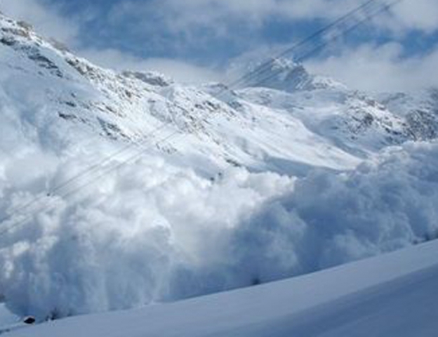
The backcountry avalanche danger is considerable Wednesday as winds are redistributing storm snow into slabs on lee slopes, the Canadian Avalanche Centre is warning.
However, although West Kootenay backcountry cornices are large — and could trigger an avalanche on the slope below — the avalanche danger is expected to lessen to moderate for the rest of the week, said CAC’s Penny Goddard.
Direct sun hitting new snow is likely to trigger loose snow avalanches, she said in her report. But danger levels will be highly variable across the region as snow showers arrive in an unpredictable fashion.
“Be alert to your local conditions,” she said. “Any time there is rapid loading by new snow or wind-loading, expect the local avalanche danger to be elevated.”
Unsettled conditions with patchy snow flurries and possible thunderstorms will hit the region Wednesday, with light patchy snowfall, clearing up towards the evening on Thursday. Friday will be sunny and clear.
Numerous loose snow and soft slab avalanches in the size one to two range were triggered naturally by skiers and by explosives over the last few days.
Up to 60 centimetres of new snow overlies previous storm snow above 1,900 metres and a crust below about 1,900 m. Several buried sun crusts exist in the upper snow pack, particularly on solar aspects.