Avalanche conditions worsen for weekend in West Kootenay backcountry

By Nelson Daily Staff
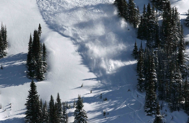
Avalanches continue to be a real threat as the danger rises to considerable this weekend in the West Kootenay backcountry.
Several loose snow avalanches up to size 1.5 were reported during sunny periods over the past week, the Canadian Avalanche Centre’s Peter Marshall reported.
One size 2.5 slab avalanche was reported on an east aspect in the alpine in Kokanee Glacier Park early in the week.
“Expect an increase in avalanche activity, particularly on Sunday, as temperatures rise and solar radiation increases,” he said. “It looks as though we could finally see a transition from winter to spring this week.”
Avalanches are likely on steep south-facing slopes in the afternoon when the sun is out (even briefly). Cornices are very large in some areas and continue to pop off, occasionally triggering large avalanches.
At this time of year avalanche danger is generally lower early in the day when temperatures are cool; the sun is not yet affecting slopes or cornices above, and a strong supportive melt-freeze crust exists.
Danger increases as temperatures rise, solar radiation intensifies, and surface snow becomes wet or slushy.
“If wet snow does not freeze overnight or if it’s raining, all bets are off no matter what time of day,” said Marshall.
Around 20 centimetres of new snow sits on a relatively well settled and deep spring snow pack.
Some generic advice for spring conditions
Be prepared to alter plans, adjust routes to avoid avalanche terrain, or even turn around and go back if you see signs of increasing danger, such as more than five centimetres or so of wet/slushy surface snow, pinwheeling, and snowballing.
Be vigilant and keep an eye on what’s going on above you at all times. A loose wet slide or a cornice failure could hit you or trigger an avalanche even if you’re on a shaded slope that feels cold at the time.
If it snows, avalanche danger is generally highest during and shortly after storms or squalls, especially in lee and cross-loaded terrain and if more than 20-30cm of new snow lies on a smooth hard crust.
As winter passes into spring
The CAC will now issue weekly updates on Thursdays until spring conditions are fully established or the May long weekend, whichever comes first.
Where possible, the CAC will include danger ratings for the weekend (the first three days of the forecast period).
The CAC needs information from the field. Please send your observations to [email protected].