Sunday snow worsens avalanche conditions in backcountry

By Nelson Daily Editor
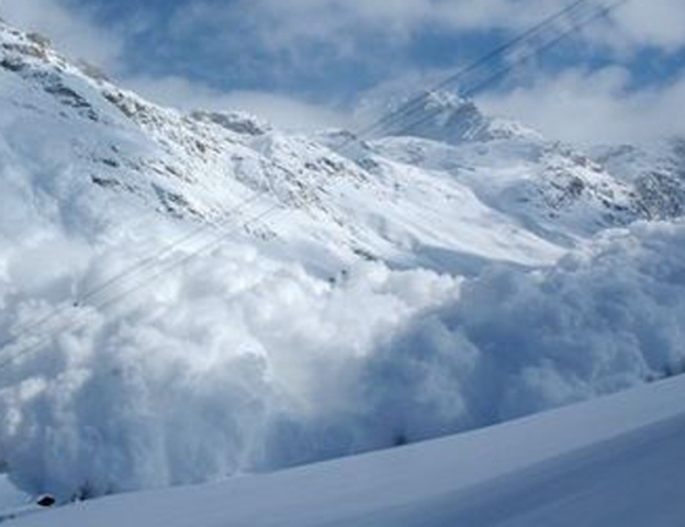
The potential for an avalanche in the West Kootenay backcountry is considerable for the next two days above the alpine, according to the Canadian Avalanche Centre.
A new storm in the backcountry brewing overnight Sunday spells disaster, said CAC’s Shannon Werner, but if the region receives heavier amounts of snow and stronger winds the danger rating may be elevated.
“The new storm snow may not bond well with old surfaces,” she wrote in her report.
Up to 20 centimetres was expected Sunday night. Below this lies 30 cm. of dry, facetted snow that fell last weekend.
There have been numerous small slab avalanches occurring in the northwest areas of the West Kootenay. These have failed on a buried surface hoar/facet layer that lies beneath the current storm snow, Werner reported. Rider triggered avalanches are likely.
There was also a natural size three avalanche reported on a southeast slope above 1,900 metres. It was spotted from three kilometres away.
“This makes me believe that deeper instabilities on specific terrain features may exist,” said Werner.
Areas of concern continue to be steep slopes — where loose snow can gather mass and speed — and wind loaded slopes.
Backcountry users are advised to avoid wind loaded slopes or parts of slopes. These may look fat, rounded, smooth and feel stiff.
Weather forecast
Monday: Flurries ending in the afternoon with a mix of sun and cloud. Winds moderate from the northwest. Freezing levels at valley bottom.
Tuesday: Cloudy, temperatures near -4C in the valley.
Wednesday: Mix of sun and cloud with drier cooler conditions.