New snow in backcountry compounds avalanche risk
By Timothy Schafer, The Nelson Daily
Avalanche risk is still rated at high in the West Kootenay backcountry above and in the tree line, while considered considerable at lower elevations, according to the Canadian Avalanche Centre.
The risk continues at considerable until Monday, but avalanche problems are occurring due to significant wind-loading occurring across the region, said Shannon Werner of the CAC.
Wind slabs can be found mainly on north to northeast aspects, she said in her report Friday, with persistent weak layers existing in the snow pack in all areas of the backcountry — becoming reactive with the new snow.
There has been up to 40 centimetres of storm snow with an additional 15 cm. in the forecast today (Saturday). This new snow load may not bond well with the weak snow surfaces, Werner reported.
As a result, the CAC has issued a special Public Avalanche Warning for the region of the West Kootenay, and those dangerous avalanche conditions will persist through the weekend.
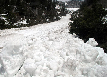
There have been numerous avalanches in the region, Werner noted, up to a size two and reacting mainly on the Jan. 3 surface hoar layer. This is the first report of a deeper instability waking up and becoming an avalanche concern, Werner said.
Travel in avalanche terrain is not recommended during periods of high danger, and the CAC advises staying well away from avalanche paths and run-out zones.
“Seek powder turns inbounds at your local ski hill, and snowmobile in areas which offer zero avalanche problems for example: large meadows, or low angle trees,” said Werner in her report.
“As the storm subsides, conditions favoring human-triggering will continue, even after natural activity has died down. I recommend sticking to simple terrain during this period.”
Up to 30 cm. of snow has fallen across the region and is accompanied by moderate-strong southwest winds. This new snow overlies a weak upper snowpack. There are several buried surface hoar and crust layers in the upper pack and the Dec. 7 surface hoar / facet/crust layer down 80 cm.
These upper layers are starting to become reactive as more wind and snow hits the region.
Weather forecast
Saturday: Few flurries with temperatures near –five degrees C. Winds switching to the northwest.
Sunday: Cloudy, scattered flurries. Temperatures around -5C with light northerly winds.
Monday: Clear and sunny skies. Temperatures dropping low near -8C.


