Eyes in the sky temporarily shut down wildfire fighting operation near Nakusp

By Timothy Schafer Local Journalism Initiative Reporter
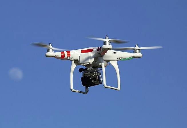
The use of civilian drones near Nakusp has caused some problems for those fighting wildfires.
Although the use of drones near a wildfire is strictly prohibited and illegal, it may not be widely known. People operating unmanned aerial vehicles (drones) on Saturday, July 10 near the Kimbol Lake fire — 10 kilometres east of Nakusp — forced BC Wildfire Service staff to temporarily halt air operations.
“This situation resulted in a helicopter being grounded,” noted a Southeast release on Tuesday.
“The presence of drones near an active wildfire can slow down, or completely shut down aerial firefighting efforts, due to safety concerns. If a drone collides with firefighting aircraft, the consequences could be deadly.”
Under Canadian Aviation Regulations, all wildfires are automatically considered to be “flight restricted,” which includes a radius of five nautical miles around the fire and an altitude of 3,000 feet above ground level.
Anyone caught operating a drone that interferes with fire control could be fined up to $100,000, or jailed for up to one year, or both.
“This fire is producing smoke that may be visible from Nakusp and surrounding areas, as well as to motorists traveling on Highway 6 and Highway 23 in the area,” noted a BC Wildfire Service
Release from the Southeast Fire Centre.
Kimbol is currently estimated to be 47 hectares (ha.) in size and is not currently threatening structures.
Smokey skies continue
The smoke from the Kimbol Lake fire has added to the smoke in the sky drenching a good section of the West Kootenay, including the skies of Nelson.
There are three fires heating up in the Slocan Valley — but are still classed as moderate — and are sending smoke over the mountains to the Queen city, instead of smoke travelling in from the Okanagan and Kamloops where 108 fires are burning.
The closest fires to Nelson are Trozzo Creek and Christian Creek — both located about 15 kilometres northwest of Nelson — with Mount Ruppel burning about 20 kilometres north of the city.
Trozzo is the largest at 390 ha. and is considered “out of control,” with the neighbouring Christian Creek under control at .01 ha. The 130-ha Mt. Ruppel fire is 130 ha and is not currently threatening structures. All three were lightning caused.
Slightly further afield but still in the valley is the Octopus Creek fire near Passmore. Octopus Creek fire is about 34 km west of Passmore and was estimated to be about 25 ha. in size and is not currently threatening structures.
Hot times in the forest
The number of active fires burning across the province has jumped by 33 in the last two days, rising to 316, making for a total of 103 new fires this week.
Overall, the province has had 1,046 wildfires this year, with 71 currently burning in the Southeast Fire Centre region and 211 fires overall.
Most of these modified response fires are being monitored daily by either remote camera or flown by experienced officers, since they are not threatening any structures at this time.
Modified response or “monitor fires” are classified based on challenges to crew safety, distance from communities and inoperable terrain.
Other Southeast fires
Boundary Zone
• The Gladstone Park fire is about 34 kilometres north of the community of Christina Lake. The fire is producing smoke that is visible from Christina Lake and is currently estimated to be 14 ha. in size and is not currently threatening structures.
Kootenay Lake Zone
• The Cultus Creek fire is 35 km northwest of Creston. This fire is producing smoke that may be visible in Nelson, Creston and surrounding areas. It is currently estimated to be 460 hectares in size and is not currently threatening structures.
• The Akokli Creek fire is located about 7.5 km east of the community of Boswell. This fire is producing smoke that may be visible in the area and is estimated to be 95 ha. in size and is not currently threatening structures.
• The Kamma Creek fire is located approximately 32 km northeast of Creston and is burning in high terrain in the Goat Creek drainage. It is estimated to be 140 ha. in size and is not currently threatening structures.
Source: Southeast Fire Centre data
Friendly fire
It might be a hot topic in some parts but fire is an essential part of the ecosystem.
Wildfires help keep insects and disease under control by eliminating pathogens that could infect a stand of trees.
“This is critical given that in recent years more than five times as much timber in B.C. has been lost to insects and disease than has been consumed by wildfire,” noted a release from the Southeast Fire Centre.
According to a federal government website on the benefits of wildfire (www.fire.ca.gov) fire “removes low-growing underbrush, cleans the forest floor of debris, opens it up to sunlight and nourishes the soil.”
By thinning out the competition the trees are able to flourish. Established trees don’t have to compete with undergrowth for nutrients and space.
“History teaches us that hundreds of years ago forests had fewer, yet larger, healthier trees,” the website noted.
In addition, fire strengthens the “herd” by burning out the weaker trees and clears brush from the forest floor with low intensity flames, leaving room for new grass, herbs and re-generated shrubs.
A fire can increase the water supply by thinning the underbrush, creating less competition for water.
Source: Southeast Fire Centre; www.fire.ca.gov