UPDATED: Now it's a Snowfall Warning

By Nelson Daily Staff
Old Man Winter is making one last stand in the Southern Interior of BC.
Believe it or not, it’s nearing the end of March and Environment Canada has issued a Snowfall Warning for Boundary/Kootenay regions with expected amounts in the 15 to 20 cm range.
“A low forming over central Washington State will strengthen and move northeastwards this morning into the Kootenay regions,” Environment Canada said.
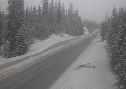
“Snow, at times heavy, is expected to develop over Kootenay Pass. Total snowfall accumulation through today is expected to be 15 to 20 cm. Total snowfall accumulation is expected to reach 15 cm today over higher terrain in the West Kootenay region.”
Environment Canada said in the Elk Valley region, snowfall accumulation is expected to be 5 to 10 cm, except as high as 15 cm for Fernie.
“As the low continues to move northeast, the heavy snow is expected to ease by late (Saturday) afternoon.”
The public is advised to be prepared to adjust driving with changing road conditions. Rapidly accumulating snow could make travel difficult over some locations. Visibility may be suddenly reduced at times in heavy snow. Weather in the mountains can change suddenly resulting in hazardous driving conditions.
ShiftIntoWinter.ca reminds drivers to know before you go. Adjust to winter driving behaviour and use winter tires and chains.
Road conditions are available at DriveBC.
Special weather statement for Paulson Summit, Kootenay Pass
Okay, enough already.
Environment Canada has issued a Special Weather Statement for Highway 3, Paulson Summit to Kootenay Pass.
Environment Canada said there will be an abrupt transition back to winter conditions Thursday afternoon for the Coquihalla, Okanagan Connector and Highway 3 – Hope to Princeton via Allison Pass.
“A strong cold front will move across southern B.C. later today. Ahead of the cold front this morning, rising freezing levels will bring mostly rain to the passes,” Environment Canada said.
“The passage of the cold front late this afternoon will bring a sudden change in precipitation from rain to heavy snow over the highways resulting in sudden reduced visibility and possible rapid accumulation of snow. Total snow accumulations of 10 to 15 cm are possible from this afternoon through tonight.”
Over Kootenay Pass, snow will persist today. Due to higher freezing levels, the snow may become wet or mixed with rain at times. Total snow accumulations of 15 to 20 cm are expected.
Travellers are advised to exercise caution if travelling today and to be aware of rapidly changing road conditions.
Weather in the mountains can change suddenly resulting in hazardous driving conditions.
Road conditions are available at DriveBC.