Unsettled weather forecast could bring heavy rain to heavy snowpack

By Timothy Schafer Local Journalism Initiative Reporter
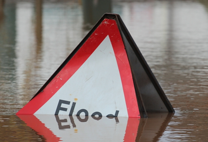
The upcoming weather forecast is predicting continued unsettled conditions throughout the province while a significant risk builds over the short-term for a potential heavy rain to fall on a melting snow pack.
According to the latest B.C. River Forecast Centre Snow Survey and Water Supply Bulletin, an unsettled weather forecast and more rain could combine with the region’s snowpack — 215 per cent of normal — to create flooding conditions as the spring melt continues to build.
The snow survey and water supply bulletin has assessed the progression of spring snowmelt as delayed in the region. As a result, the flood risk in the West Kootenay remains high due to delayed melt of the mountain snowpack and the continued unsettled weather conditions.
The June 15 snow pack is well above normal, increasing to 215 per cent of normal — the average of all snow measurements across the region — over the past two weeks (where June 1 was 128 per cent).
The view on top
The snow on the ground in the alpine regions has typically melted significantly by this time of the year (75 per cent), the centre noted.
The cooler weather of April and May means the snow pack melt has been delayed by nearly four weeks, poising the region as relatively high risk for flooding.
Snow pack is only one factor related to freshet flood risk, the forecast centre noted in its release, with weather conditions through June and July determining the timing, magnitude and rate of snowmelt, with heavy rainfall events complicating the situation.
“These large snow basin numbers reflect a delay in melt, and not continued accumulation of snow from peak levels,” the survey read.
The province has well above normal snow pack for June 15, with the average of all snow measurements across the province at 198 per cent, increasing from 165 per cent on June 1.
“It is important to note the total snow depth is not increasing,” noted the bulletin.
“Instead, this high anomaly happens in June during years of delayed snowmelt when current snow levels are compared to normal values that are small due to more advanced snowmelt.”
Snow basin index values at this time of year are compared to a normal value that is typically dropping quickly.
Record it
This year, five stations measured record high snow values for June 15, including two sites in the West Kootenay:
- St. Leon Creek: 1,354 mm SWE (268 per cent of normal) — period of record 28 years;
- Redfish Creek: 1,793 mm SWE (194 per cent of normal) — period of record 20 years.
Most rivers throughout the region have risen to normal to above normal levels as of June 15.
“Rivers are currently extremely vulnerable to heavy rainfall events because flows are relatively high,” the bulletin predicted.
Making the record
Data is from nine manual snow courses and 88 automated snow weather stations around the province (collected by the Ministry of Environment and Climate Change Strategy’s Snow Survey Program, BC Hydro and partners).
Climate data is from Environment, and Climate Change Canada and the provincial Climate Related Monitoring Program have been used to form the basis of the report.