Increased area restriction for Trozzo Creek, Mt Rupple wildfires

By Contributor
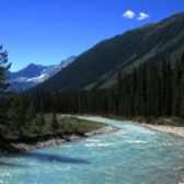
The BC Wildfire Service has increased the area of the Area Restriction Order for the vicinity of the 4,389 hectare Trozzo Creek and Mt Ruppel wildfires near Winlaw and Slocan, respectively.
The increased area restriction reflects the continued need to protect the public in areas where ongoing fire suppression activities are taking place and to avoid interference with fire control.
Due to the increase of this order into part of Kokanee Glacier Provincial Park, please visit BCParks.ca for information on access and closures in BC Parks.
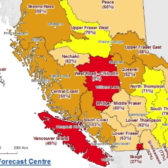
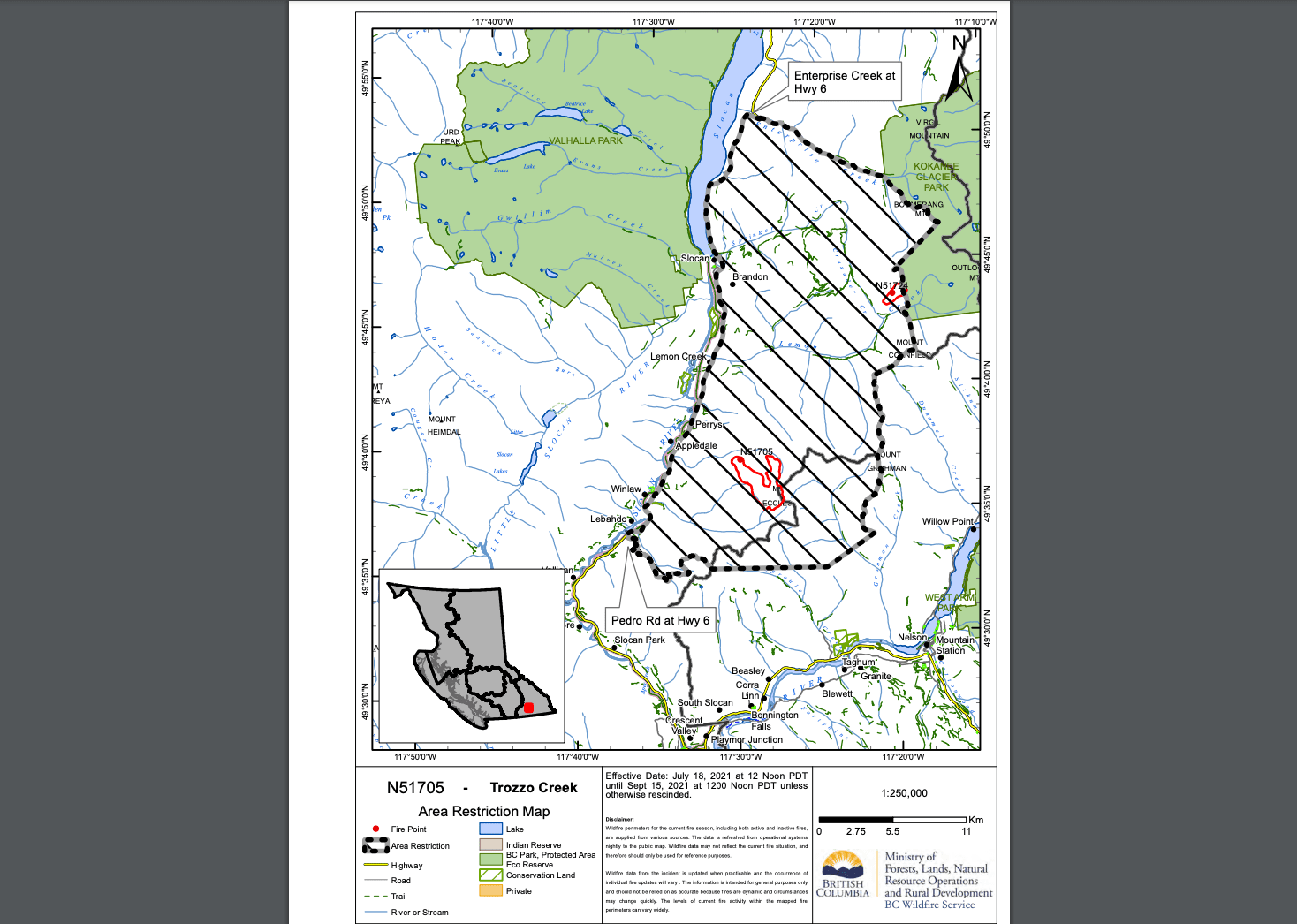
This order is currently in effect and will remain in effect until 12:00 noon (PDT) on September 15, 2021, or until rescinded. The order applies to Crown land within the geographic boundaries described below and outlined in the correlated map:
Trozzo Creek wildfire (N51705), originated 7 kilometres east Winlaw and Mt Ruppel wildfire (N51724), originated 13 kilometres east of Slocan:
- Commencing from the intersection of Pedro Rd and Highway 6 East up the Pedro Creek FSR to the height of land on Pedro-Donut FSR.
- Then east to Mount Peters and northeast to Baldface Ridge.
- Following the height of land north through Mount Grohman the summit of Duhamel Creek FSR to Mount Cornfield.
- Then bearing north following the height of land into the South West corner of Kokanee Glacier Park then following the height of land along Outlook Mountain, Sunset Mountain, Mount Giegerich and Nansen Mountain to continue along the Kokanee Glacier Park boundary North to Enterprise Creek.
- Then follow Enterprise creek West to Highway 6 and follow Highway 6 south to the point of commencement.
Note: Access to private land recreational areas and sites adjacent to Highway 6 are permitted.
Trozzo Creek and Mt Ruppel wildfires combined Area Restriction Order Map: http://ow.ly/Zf6350FF1bM
Under this Order and section 11(2) of the Wildfire Act, a person must not remain in or enter the restricted area without the prior written authorization of an official designated for the purposes of the Wildfire Act, unless the person:
1. first receives written authorization of an official designated for the purposes of the Wildfire Act, or
2. Enters the area only in the course of:
(a) travelling to or from his or her principle residence that is not under an evacuation order;
(2) using a highway as defined in the Highway Act;
(3) travelling as a person acting in an official capacity as defined in s.56 of the Wildfire Act; or
(4) travelling for the purpose of supporting wildfire suppression or enforcement patrol activities
This Order is subject to and subordinate to any applicable evacuation orders made under the Emergency Program Act.
Failure to comply with Section 11 restricted area requirements may result in a violation ticket of $1,150.
Road closures and area restrictions are subject to change depending on fire activity. For the most current information please visit the bans and restrictions section of the BC Wildfire website for the Southeast Fire Centre, or visit: http://ow.ly/k5jT50Fvlk3
The Southeast Fire Centre extends from the U.S. border in the south to Mica Dam in the north, and from the Okanagan Highlands and Monashee Mountains in the west, to the B.C.-Alberta border in the east.