August sees more rain than in previous years

By Lone Sheep Publishing

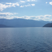
Six months of below-average precipitation ended in August said the Southeast Fire Centre in its monthly weather synopsis.
The increase in precipitation, which slowed the spread of wildfires in the region, was caused by a significant shift in the large-scale circulation that allowed approximately ten waves of moisture during the month of August.
August also saw the region deal with several days of air quality warnings as smoke was trapped in the valley bottoms from wildfires in the southern interior of the province.
“Some were associated with upper lows and the rest rode in on upper troughs,” the Southeast Fire Centre media release said.
“Some originated over the central/north Pacific and others tapped into a feed of moisture from the subtropics.”
Most of these features brought rain to the area, contributing to a monthly total of almost 86mm which is roughly 2.8 times (or around 55mm) more than the monthly average of 30.4mm said the Southeast Fire Centre.
“There were twice as many days with thunderstorms as are normally reported during the month,” the Southeast Fire Centre said.
“This was not the wettest August on record, but it was the wettest of at least the last ten years.”
The Southeast Fire Centre said August was the first month since January with above average precipitation, which is a surprise considering August is usually the driest month of the year.
“While total rainfall was well above average, the amount in excess of average this month (55mm) is still significantly less than the cumulative moisture deficit of over 200mm since March 1,” the Southeast Fire Centre said.
The Southeast Fire Centre said the heaviest rain came with thundershowers on August 8th with a new daily record of 29mm while the record for the most amount of rain in one day for the month of August is 42.9mm.
The Southeast Fire Centre said some nearby areas may have exceeded this value since there were reports of highly variable amounts over relatively short distances that day.
“One daily minimum temperature record (+5.8 on August 24th) was matched but not broken in the early morning hours of the 24th with calm winds and clear skies under a cool and dry northerly flow,” the Southeast Fire Centre said.
The Southeast Fire Centre said the mean monthly temperature was slightly above normal despite above-average rain and above-average number of days with rain.
After a few hot days, the Environment Canada website said weather for the next week is expected to be sunny, with high temperatures ranging in the mid-20’s during the day and low teens overnight before dropping into the high teens during the day the following week.