Area Restrictions in effect for Gladstone Creek Wildfire north of Christina Lake

By Boundary Sentinel
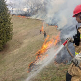
The BC Wildfire Service has implemented two Area Restriction Orders for the vicinity of the Dewar Creek wildfire northwest of Kimberley and Gladstone Creek wildfire north of Christina Lake.
The BC Wildfire Service said these area restrictions reflect the continued need to protect the public in areas where ongoing fire suppression activities are taking place.
Each order are currently in effect, and will remain in effect until 12 noon (PDT) on September 15, 2021, or until rescinded.
The BC Wildfire Service said the orders apply to Crown land within the geographic boundaries described below and outlined in the correlated map:
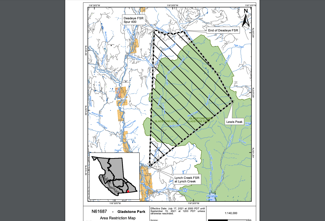
Gladstone Creek (N61687), originated 34 kilometres north of Christina Lake:
- Commencing at Lynch Creek FSR at Lynch Creek
- Northeast to Lewis Peak
- North to Faith Mountain
- Northwest to the end of Deadeye FSR
- West along Deadeye FSR to Deadeye Spur 400
- South to Point of Commencement
Gladstone Creek wildfire Area Restriction Order Map: http://ow.ly/rKEt50FytX1
Dewar Creek wildfire (N11960), originated 36 northwest of Kimberly:
- Commencing at 49km Dewar FSR. Following along the height of land to Mt Patrick. North to the St Mary’s Alpine Park Boundary.
- Follow the Parks boundary northwest then north till the boundary turns west towards Wesley Creek.
- The restriction continues west along the park boundary until the height of land east of the St Mary’s River.
- It then turns south along the height of land until Armour Peak, then turns southeast along the height of land and ties back into 49km Dewar FSR.
Dewar Creek wildfire Area Restriction Order Map: http://ow.ly/Wyhj50FytSP
The BC Wildfire Service said under this Order and section 11(2) of the Wildfire Act, a person must not remain in or enter the restricted area without the prior written authorization of an official designated for the purposes of the Wildfire Act, unless the person:
- first receives written authorization of an official designated for the purposes of the Wildfire Act, or
- Enters the area only in the course of:
(a) travelling to or from his or her principle residence that is not under an evacuation order;
(2) using a highway as defined in the Transportation Act;
(3) travelling as a person acting in an official capacity as defined in s.56 of the Wildfire Act; or
(4) travelling for the purpose of supporting wildfire suppression or enforcement patrol activities.
This Order is subject to and subordinate to any applicable evacuation orders made under the Emergency Program Act.
Failure to comply with Section 11 restricted area requirements may result in a violation ticket of $1,150.
Road closures and area restrictions are subject to change depending on fire activity. For the most current information please visit the bans and restrictions section of the BC Wildfire website for the Southeast Fire Centre, or visit: http://ow.ly/k5jT50Fvlk3
The Southeast Fire Centre extends from the U.S. border in the south to Mica Dam in the north, and from the Okanagan Highlands and Monashee Mountains in the west, to the B.C.-Alberta border in the east.