UPDATED: Winter Storm Warning for Paulson Summit to Kootenay Pass

By Nelson Daily Staff
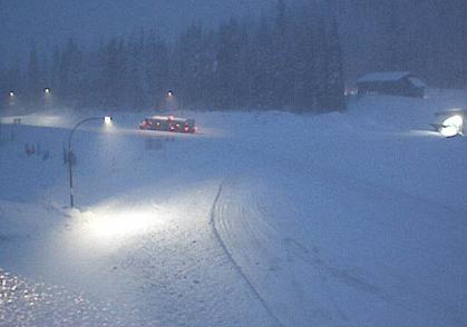
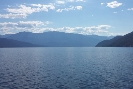
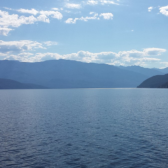
Environment Canada has ended its Snowfall Warning, but drivers can still expect hazardous winter conditions on Highway 3, Paulson Summit to Kootenay Pass.
On its website, Environment Canada said a Pacific frontal system will track across southern B.C. today bringing heavy snow Tuesday and tonight giving 30 to 50 cm.
“Total accumulations near 70 cm is likely by Wednesday morning” Environment Canada said. “Snow will ease Wednesday morning as the system exits the province.”
Storm totals from this two-day event have reached 38 cm (as of 3 pm PST) and a further 10-20 cm is expected before precipitation eases Wednesday afternoon.
Environment Canada said travel is not recommended as rapidly accumulating snow and drifting snow will make driving conditions very difficult.
“Poor weather conditions are likely to contribute to long-lasting transportation delays,” Environment Canada said. “Expect road closures as avalanches are possible.”
Weather in the mountains can change suddenly resulting in hazardous driving conditions.
Shift Into Winter reminds drivers to know before you go. Adjust to winter driving behaviour and use winter tires and chains.
Road conditions are available at DriveBC.
Get ready for another blast of winter — Snowfall Warning issued
Get ready for another blast of winter.
Environment Canada has issued another Snowfall Warning Monday for Boundary, West Kootenay, Arrow Lakes-Slocan Lake regions.
Environment Canada said these regions can expect a long period of snowfall with total amounts of 20 to 30 cm.
“A Pacific frontal system will push into southern BC today and then remain stationary over the region through Tuesday,” the Environment Canada said website said. “Steady snow is forecast to begin this morning and then become heavy at times by tonight. Total snowfall accumulations of 20 to 30 cm are expected through Tuesday morning.
Environment Canada said the snow is forecast to change over to rain on Tuesday as a milder southerly flow develops.
The public should consider postponing non-essential travel until conditions improve as visibility, especially for the mountain passes including Highway 3 from Paulson Summit to Kootenay Pass, may be suddenly reduced at times in heavy snow.
Environment Canada said heavy snowfall accumulation may cause tree branches to break and advise the public to take frequent breaks and avoid strain when clearing snow. Last week, a winter storm combined with warmer temperatures caused major power outages throughout the Nelson, Slocan Valley, Kaslo, Balfour and Crawford Bay areas.
Yellowhead Road & Bridge is advising public to take extra care as school re-opens from the Christmas Holiday break Monday.
Shift Into Winter reminds drivers to know before you go. Adjust to winter driving behaviour and use winter tires and chains.
Road conditions are available at DriveBC.