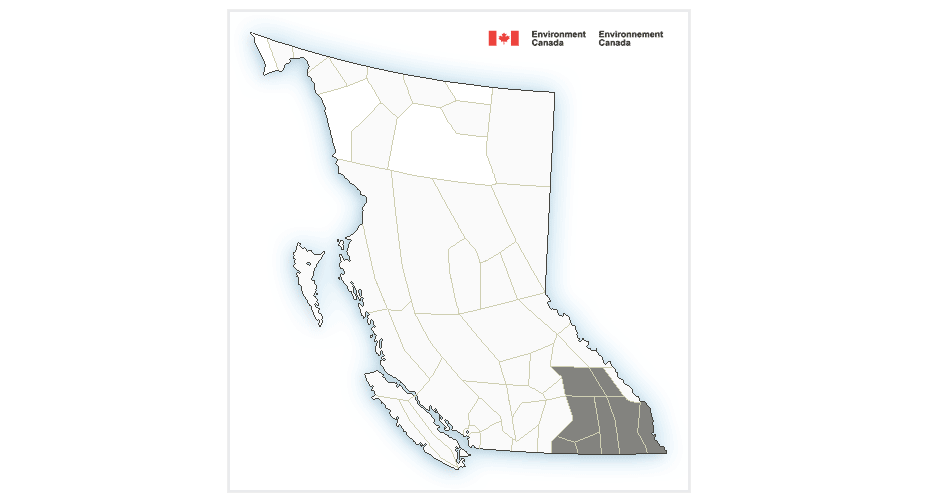
Special Weather Statement remains for Boundary, Kootenay, Arrow/Slocan Lakes

By Nelson Daily Staff
Environment Canada has downgraded its weather watch to a Special Weather Statement following Saturday nights thunderstorms that hammered the southern interior of BC.
Environment Canada said a significant amount of rainfall will fall in the Kootenays Sunday due to a band of thunderstorms that moved up from Washington State through the southern Interior Saturday night, which produced extensive lightning, gusty winds and 5 to 20 mm of rainfall.
“Another disturbance will move into B.C. from Washington this morning, producing more rainfall today over the Kootenays and Columbias,” Environment Canada said.
“Additional rainfall amounts of 10 to 25 mm are forecast for today, with up to 35 mm where rainfall is enhanced by morning thunderstorms.”
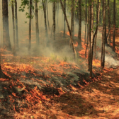
Environment Canada said potential impacts from thunderstorms and widespread rainfall include: rising rivers, downed trees, flash flooding, and danger to those recreating or working outside.
Environment and Climate Change Canada meteorologists will continue to monitor the situation.
For more information on river flow forecasts, and flood warning and advisories, please visit the BC River Forecast Centre website at http://bcrfc.env.gov.bc.ca/warnings/index.htm
Severe Thunderstorm warning issued for Boundary, West Kootenay and Arrow/Slocan Lakes
Environment Canada has issued a Severe Thunderstorm warning for Saturday evening in the southern interior of BC, including Boundary region, West Kootenay and Arrow/Slocan Lakes.
Environment Canada said conditions are favourable for the development of severe thunderstorms thanks to a low pressure system will move into B.C. from Washington that may be capable of producing strong wind gusts, large hail and heavy rain.
Potential impacts from thunderstorms and widespread rainfall include: rising rivers, downed trees, flash flooding, and danger to those recreating or working outside.
“Strong thunderstorms will develop over Fraser Canyon north, South Thompson, Nicola and Similkameen (Saturday) afternoon,” Environment Canada said.
“Heavy downpours and strong wind gusts are possible with these thunderstorms.”
Environment Canada said strong thunderstorms will develop over Okanagan, Shuswap, Boundary region, West Kootenay and Arrow Slocan Saturday evening, with the main hazards are heavy rainfall rates (up to 10-25 mm/h), very strong winds up to 80-100 km/h, 1-2 cm hail, and intense lightning.
Additionally, widespread rainfall will accompany the low pressure system overnight and Sunday. Total rainfall amounts of 20 to 40 mm except up to 50 east of the Okanagan valley are expected by Sunday afternoon.
Environment Canada said fast-moving water across a road can sweep a vehicle away. Large hail can damage property and cause injury.
“Strong wind gusts can toss loose objects, damage weak buildings, break branches off trees and overturn large vehicles,” Environment Canada said.
“Intense lightning is likely with any thunderstorm that develops. Heavy downpours are likely to cause flash floods and water pooling on roads.”
Environment Canada said severe thunderstorm watches are issued when atmospheric conditions are favourable for the development of thunderstorms that could produce one or more of the following: large hail, damaging winds, torrential rainfall.
Please continue to monitor alerts and forecasts issued by Environment Canada.